Searching for property in Toronto, ON almost always starts with narrowing down exactly where you want to be. Canada uses a six-character alphanumeric postal code system – different from the five-digit zip codes you’ll find in the United States.
Knowing how these codes work helps you target specific neighbourhoods across the Greater Toronto Area (GTA). One postal code can represent a single block, a large apartment building, or a major commercial centre. That range matters more than most buyers expect.
Quick Facts About Postal Codes in Toronto, ON
The Canadian postal code format alternates letters and numbers: A1A 1A1. The first three characters make up the Forward Sortation Area (FSA), which identifies a broad geographic district. The final three characters are the Local Delivery Unit (LDU), narrowing things down to a specific street, block, or even a single high-rise. Toronto’s postal system is divided into a relatively limited number of Forward Sortation Areas (FSAs), each covering a broader geographic area. The final three characters form the Local Delivery Unit (LDU), which can narrow a postal code down to a specific block, building or large-volume mail recipient.
The Forward Sortation Area (FSA)
Postal codes beginning with the letter “M” broadly identify the Metropolitan Toronto postal geography. That makes the M prefix useful for understanding the general region, but it should not be treated as a precise test of City of Toronto municipal boundaries.
For a buyer, the full postal code is far more useful than the first letter alone. Postal codes can help narrow a property search, but neighbourhood names, municipal boundaries, school catchments and transit access should also be checked separately.
The second character, a number, indicates whether the area is urban or rural. In Toronto, that number is always followed by another letter to complete the FSA and outline a specific section of the city.
The Local Delivery Unit (LDU)
The last three characters pinpoint the exact destination for mail and packages. For you as a buyer, that level of detail is useful for identifying precisely which block a listing sits on.
Some large condo buildings or corporate headquarters have their own dedicated LDU, meaning a single high-density address might have a postal code entirely to itself.
Finding Specific Areas: The Toronto Postal Code List
Buyers searching by postal code are usually trying to stay within a specific commute radius. Real estate portals and local MLS listings let you filter properties by entering just the first three characters of a code – which is genuinely the most practical way to use them.
Because each six-character postal code identifies a much more specific delivery area, there are many individual postal codes across the Toronto region. For real estate purposes, however, buyers rarely need a master list. The FSA – the first three characters – is generally more useful for understanding a broad search area, while the complete postal code can help identify a specific building, block or address. For most buyers, the FSA level is the right tool for understanding which part of the city a property sits in.
The Financial District and M5H 2N5
Downtown Toronto has highly concentrated postal codes given the volume of commercial and residential towers packed into a small footprint. The postal code M5H 2N5, for example, covers a specific portion of the Financial District in downtown Toronto – addresses sharing that code sit right in the middle of the city’s primary corporate hub. Buyers looking at condos in this exact area will find themselves in one of the most densely populated parts of the province.
Adjacent Downtown Districts
Moving just a few blocks away from the Financial District changes the postal code entirely. Neighbourhood boundaries often align with postal boundaries, though not always perfectly – and that gap can cause confusion if you’re relying on neighbourhood names alone.
Checking the exact code on a listing confirms its location relative to major transit lines and amenities. It’s a small step that prevents a surprising number of misunderstandings.
Viewing the Toronto Postal Code Map
A postal code map gives you a visual breakdown of how the city is divided. The “M” codes cover the entire municipality, wrapping around the Lake Ontario shoreline and extending north to the city limits.
Real estate agents use these maps to show buyers where different housing types tend to cluster. One thing the map makes immediately clear: the downtown core features small, tightly packed FSAs, while the outer suburbs have much larger geographic zones. That difference in scale reflects the difference in density – and, by extension, the difference in how you’ll experience daily life in each area.
Reading Boundary Lines
Major roads, ravines, and rail lines typically serve as the dividing lines between FSAs. Cross a major arterial road and you’ve usually crossed into a new postal code zone.
These boundaries help you understand the physical layout of the city in a way that neighbourhood names sometimes don’t. A map makes it easy to see which codes border the lakefront versus those located further inland.
Neighbourhood and City Designations
Postal codes locate an address – they don’t define a neighbourhood. A single code might cover parts of two distinct historical districts, which means you can’t use the code alone to understand community character.
Use postal maps as a geographic tool. The code tells you where the house is. Local signage and history tell you what kind of place it is.
Why Postal Codes Matter When You’re Buying
For Toronto buyers, postal codes are useful because they sit at the intersection of georgraphy and property search.
A buyer looking for a condo near a particular subway station may use postal codes to narrow the search to a handful of buildings. A family may use an address to check the relevant school information. An insurer may ask for the exact postal code when quoting coverage. And a buyer comparing two listings that appear to be in the same neighbourhood can use the address and postal code to confirm exactly where each property sits.
But a postal code is not a substitute for understanding the neighbourhood itself. Toronto’s neighbourhood boundaries can be informal, overlapping or interpreted differently depending on who you ask. Two homes with similar postal codes can have different commutes, housing stock and streetscape.
That is why we tend to look beyond the postal code when helping buyers. The question isn’t simply “What area is this?” It’s “What does living here actually look like?”
What County Is Toronto In?
Buyers relocating from the United States or other provinces often ask about county governments and how taxes are structured. The short answer: the City of Toronto is a single-tier municipality in Ontario, meaning it’s not part of any county or regional municipality.
There’s no county-level government handling services like policing or waste management. The municipal government manages everything, and property taxes are paid directly to the City of Toronto rather than split between a city and a county.
The Greater Toronto Area Context
Toronto operates independently, but it sits at the centre of the Greater Toronto Area (GTA). The GTA includes surrounding regional municipalities – Peel, York, Durham, and Halton – which function similarly to counties. Toronto itself remains separate from all of them.
Commuters cross these municipal borders daily, but the property tax and governance structures change the moment you leave city limits. That’s worth keeping in mind if you’re comparing properties on both sides of the boundary.
Single-Tier Municipality Status
Operating as a single-tier municipality streamlines local administration. You deal with one local government body for all permits, property taxes, and civic services – no layered jurisdictions to sort through.
It also affects how real estate data gets reported. Market statistics routinely separate the City of Toronto from the rest of the GTA, which gives you a more accurate read on the immediate urban market rather than a blended regional average.
Postal Codes by Toronto Neighbourhood
Specific landmarks and districts have recognizable postal codes that locals come to know over time. The downtown core, the waterfront, and the northern suburbs all feature distinct alphanumeric patterns.
When you’re searching for a home, knowing the FSA for your target neighbourhood speeds up the process considerably. A quick look at a listing’s address tells you immediately whether it’s in the right part of town.
Downtown and the CN Tower
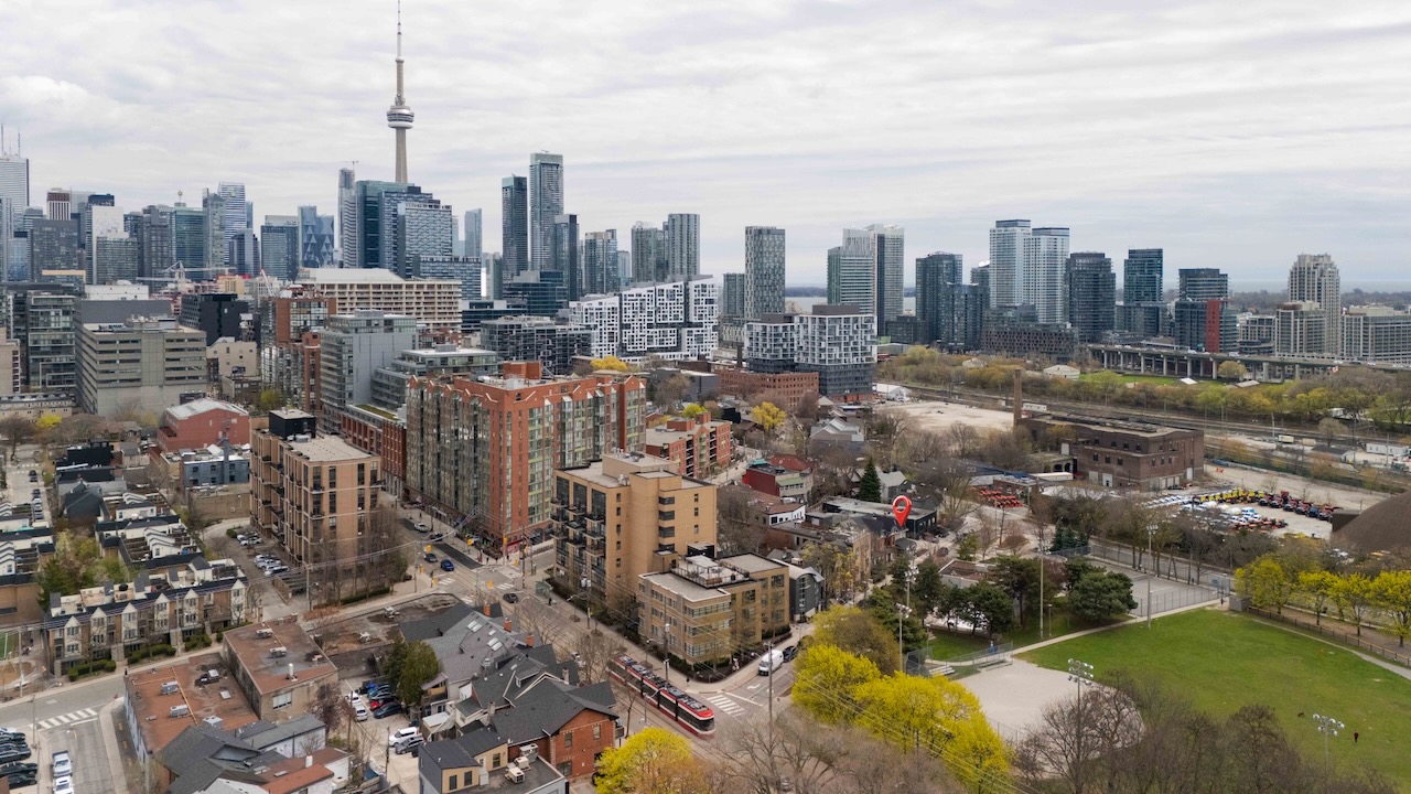
The area surrounding the CN Tower sits at the center of the downtown core, and the postal codes here serve high-rise condominiums, office buildings, and major entertainment venues. Properties in this district place you within walking distance of major transit hubs. The density means a single city block might contain multiple unique postal codes.
Kensington Market and Surrounding Areas
Kensington Market is a specific neighbourhood with a distinct commercial and residential mix, and the postal codes covering it reflect a dense, walkable street grid. Houses here are typically older, attached or semi-detached properties. If you’re targeting Kensington Market specifically, using the local FSAs helps you filter out listings in adjacent, higher-rise neighbourhoods – which saves time.
Telephone Area Codes for Toronto
Toronto uses several telephone area codes to handle its population. The original and most recognized is 416 – it’s deeply tied to the city’s identity, and many long-time residents and established businesses hold onto those numbers.
Due to population growth, the city also uses the 647 and 437 overlay area codes. All three serve the exact same geographic area within the City of Toronto boundaries, so there’s no difference in service between them. Providers issue 647 or 437 numbers to new accounts when 416 numbers are unavailable.
The 647 and 437 codes require ten-digit dialing for all local calls within the city. This overlay system means the city doesn’t have to be split into separate geographic calling zones. If you’re moving to the area and setting up local utilities and services, you’ll likely receive one of these newer codes.
How to Look Up a Full Postal Code
Finding the exact six-character code for a property requires the street number, street name, and municipality. Canada Post maintains the official database for all addresses in the country, and they offer a free online tool that lets you type in a street address and get the exact matching code back.
Real estate contracts and mortgage applications require the complete code to process paperwork accurately. Missing a single letter or number can delay mail delivery or cause problems with legal documents – and on a home insurance application, the wrong code can produce inaccurate quotes.
One thing worth knowing: a single street can span multiple postal codes, particularly long arterial roads that cross the entire city. The code changes as the street moves through different delivery routes, so don’t assume the same code applies to all addresses on a given street. Use Canada Post’s tool to verify the specific listing you’re looking at.
Frequently Asked Questions
Do home insurance premiums for buyers vary depending on the Toronto postal code?
Yes, insurance providers use the first three characters of a postal code to assess local risk factors. Rates can change based on the specific neighbourhood’s history of claims, proximity to emergency services, and local infrastructure.
Does buying a home in a specific Toronto postal code guarantee enrollment in the local school catchment?
No, school catchment boundaries don’t perfectly align with postal code boundaries. You’ll want to verify the exact street address with the local school board to confirm enrollment eligibility.
How do I search for active MLS real estate listings using just a Toronto postal code?
Many real estate portals let you type the Forward Sortation Area – the first three characters – into the search bar. That filters the map to show only available homes within that specific geographic zone.
What do the first three characters of a Toronto postal code tell me about a neighbourhood’s boundaries?
The first three characters, known as the Forward Sortation Area, outline a broad geographic district. All codes starting with “M” are located within the City of Toronto municipality.
Which Toronto postal codes historically hold the highest residential resale values?
Resale values fluctuate, but postal codes covering central downtown areas like the Financial District tend to maintain strong pricing. Review recent comparable sales in a specific code to gauge current property values.
Can a single street in Toronto have multiple postal codes that affect my property’s official MLS neighbourhood designation?
Yes, long streets that cross through multiple districts will have different postal codes along their route. The MLS system uses the specific code tied to your street number to place the property in the correct neighbourhood category.